Levin's class has been doing a module on geology and learning about caves and karsts recently. If a pandemic weren't still happening, they would have gone on a cave field trip, but that is out of the question right now. Instead, I planned a caving adventure for just me and the kids, to explore a wild cave in Kentucky.
Liz was pretty anxious about this trip, since caving is inherently a bit of a risky activity. more so when you have little information about the cave you are going into. My initial plan was to drive 3 hours down to an area near Somerset Kentucky, where I knew about some cave entrances from a geocaching trip I did there back in 2014. But then I got in touch with someone who knew about cave a little closer, called Pine Hill Cave, and after talking with him, got enough information about this cave to plan a trip there. Having a map and some idea of what to expect in the cave helped reduce anxieties a bunch. Still, the kids, especially Levin, were not too excited about the trip. They had done some caving previously when we lived in Tennessee, but that was a while ago. Back then we also had a knowledgeable guide, my friend Natalie, which removes a lot of the uncertainty and danger. This trip would by nature of us visiting a cave we'd never been in before, would be more of an adventure and exploration. This can be thrilling or terrifying. I was hoping the kids would find it more on the thrilling side of things, as I usually find this kind of activity.
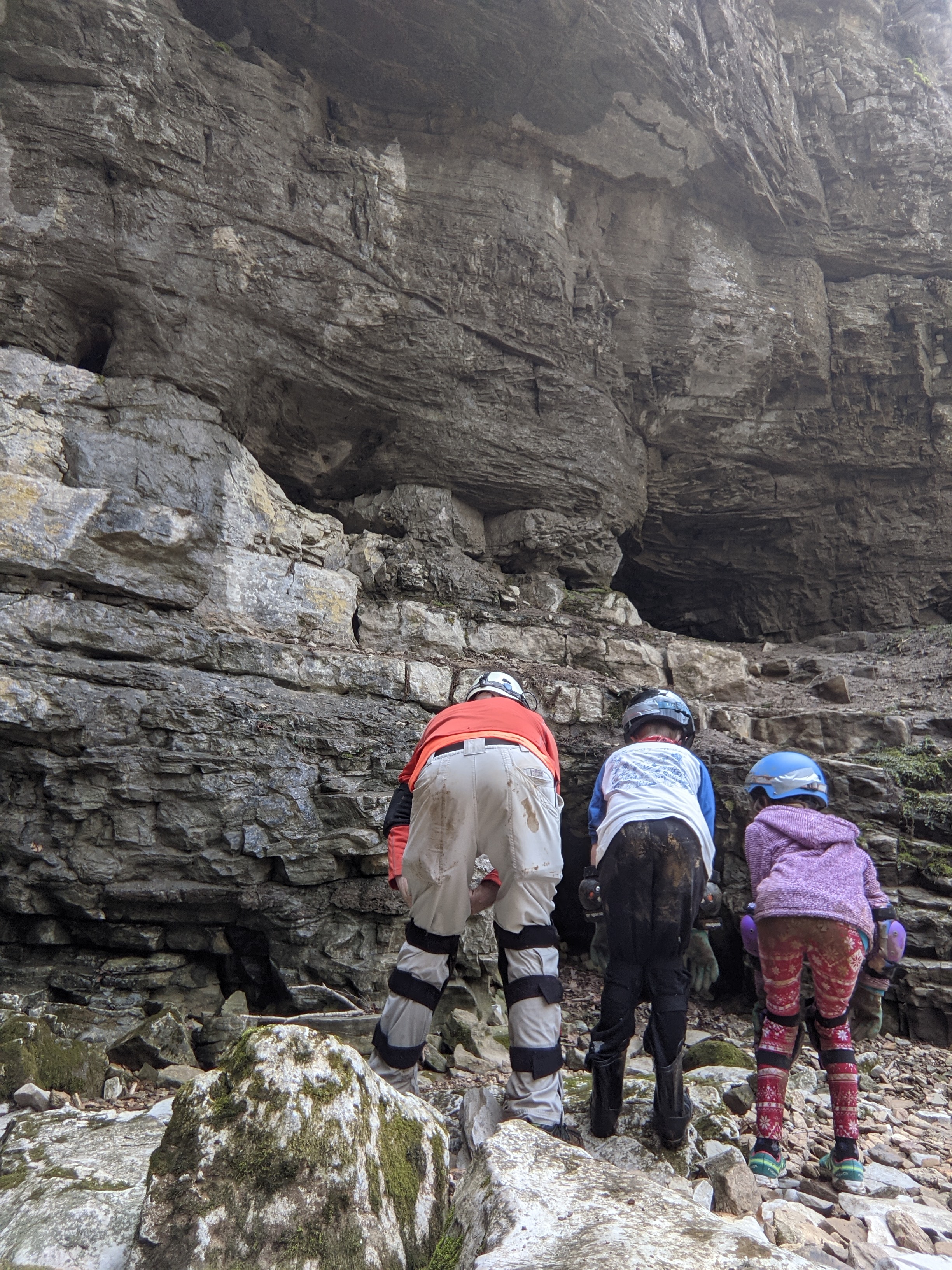
We left at a reasonable time and got to the parking spot in a reasonable time, a small pull-off on the highway just outside of Mount Vernon, Kentucky. We sorted through all the gear we would be bringing, plenty of light sources, elbow and knee pads, hard hats, and clothes we wouldn't mind getting muddy, then set off to find the entrance to the cave. This turned out to be very easy, thanks to the info I had gotten from another caver. At the mouth of the cave we put on all our gear, and sent one final text to Liz telling her we were going in.

 |
| Clean cavers, about to enter the underground realms |
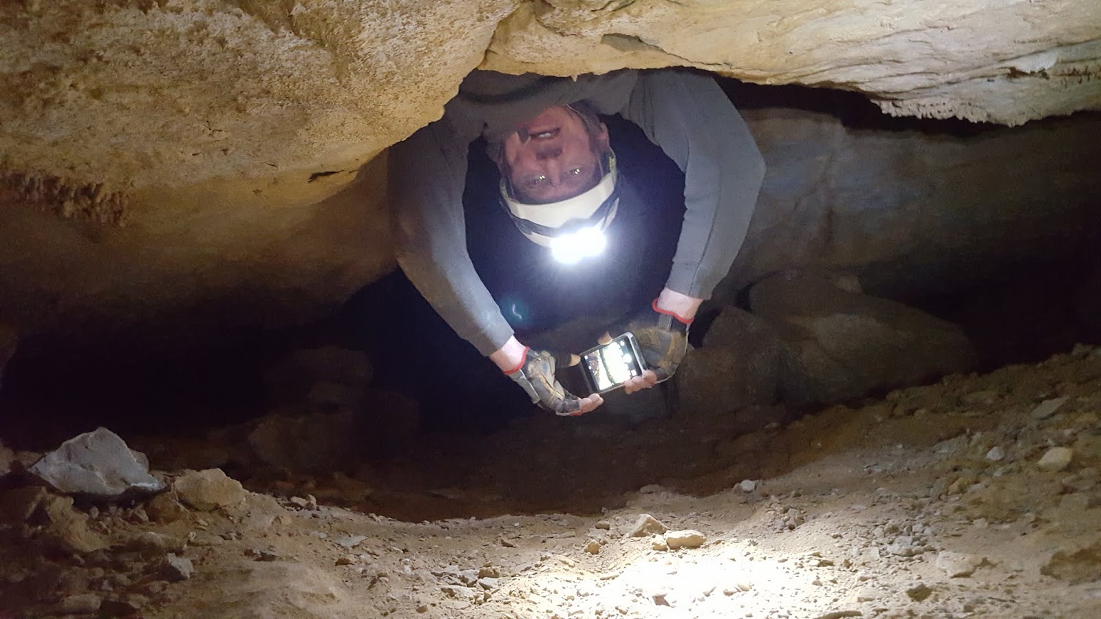
The cave entrance was nice and large, and looked to have several little branches to explore, but quite soon we were crawling on hands and knees towards the sound of rushing water. The main trunk passage of this cave is an underground stream and once we reached it it became clear that we were going to get wet on this trip. We would be traveling upstream, in the water for most of the passage. This slowed progress down a bit, and also dampened spirits. You could say it adds to the spirit of adventure to be slogging through a stream, but the kids were already a little nervous about being underground and completely on our own, and having soggy feet and chilled toes did little to make them more comfortable with this fact. We passed a couple side passages and eventually came to a spot where we either had to crawl in the stream, or take a dry looking side passage that on the map was labeled "mid section bypass". We opted for the bypass, which was easier going since it was dry. Towards the end of the bypass, where it seemed like it should reconnect with the main stream, there were two dry passage ways that had spray paint telling us they were both dead ends (which agreed with the map), but the way back to the main stream appeared to be a tight crawl under some break-down and the kids absolutely did not want to investigate this at all. The idea that we didn't really know if something connected, or even know exactly where we were on the map was dawning on them, especially Levin. Levin was getting freaked out, and was starting to whine about turning back and getting out. The more I poked around looking for the main passage way, the more vociferous he became. Ada, who up until this point had been really excited about exploring the cave, and was often out in front, started to join in with Levin about wanting to leave. Not seeing a way forward at this point, we turned back and headed to the place where the main passage was faced with a low crawl through the stream. At this point, it looked like the only way forward would be to take on this crawl in the stream, and both kids were distressed and getting close to tears about wanting to leave. We had been in the cave a little over 30 minutes. There was still so much more to explore, but I could see we were not going to get further in without a serious change in their mindset, and I didn't know how to calm the kids down. So we started heading back the way we came.

 |
| Levin looking longingly at the exit grafitti |

 |
| One of he only cave formations we found, partially defaced |
 |
| Navigating slippery rocks and streams |

 |
| Fossil Ada spotted in the ceiling |
 |
| Popcorn formations on the ceiling |
Once we were heading back, Levin calmed right down. I don't think he was all that scared to be underground,, but the idea of exploring simply was not enticing him. Instead, the fear of the un-known had been firmly planted in his mind. Going back the way we came was now calm, because we knew this passage already. He happily scrambled over the rocky obstacles, and negotiated the slippery mud as we headed back to the cave entrance. He was quick to point out the landmarks we had observed on our way in, keeping us on the right path. And soon enough we were back at the cave entrance, exiting into the sunlight.
I couldn't hide my disappointment that we hadn't spent more time in the cave. We barely saw any cave formations that Levin had learned about in his class, and there were literally miles of passageways more to explore. The really cool things about cave exploration, discovering beautiful formations, seeing rare subterranean wildlife, figuring out how to overcome obstacles, we really had only just got glimpses of. Our hour underground left me wanting more. But the kids were totally fine with being back outside. I texted Liz that we were out, and got a reply that she was glad we were all safe. We shucked off our muddy caving gear and I started thinking about how to salvage our adventure. Had we really just driven over two hours to spend only a hour underground? Were we just going to turn around and head home? I think not!


 |
| Post cave portrait |
 |
| Obligatory butt-shot showing who has the muddiest bottom (Ada wins!) |


Looking at my geocaching map, I knew there was some interesting locations to explore a short drive north from where we were. We could travel some back roads through rural Kentuckian hollows to a places of more springs and caves, possibly scout out another cave to explore in the future, and look for a waterfall to hike to. The kids thought this sounded reasonable, so off we went.
I was pleasantly surprised by how beautiful the backroads north towards Berea were. The roads followed ridge tops and hollows, and there were signs of waterfalls, limestone bluffs and possible caves everywhere. I am not at all surprised to learn that this county has a huge concentration of caves, although I bet most are on private lands. We stopped at Climax spring, which is a beautiful small waterfall along the side of the road, with a drinking pipe set up.
 |
| Climax Spring/Falls |
 |
| Levin has a taste of Climax Spring |
Just a short ways past this was a geocache placed near Climax Cave, another little cave system that might be worth exploring some time. This cave is on property owned by a nearby church, and I'd want to contact them before making a trip inside, as there are a bunch of "No Trespassing" signs posted around the cave entrance. After finding the geocache nearby, we poked our heads into the cave and immediately there were more cave formations, stalactites and stalagmites than in Pine Hill Cave. Ada seemed like she would be interested in grabbing our helmets and headlamps and exploring a bit, but Levin wasn't having it. Instead we chose to drive a bit further north to the trailhead for Anglin Falls.
 |
| Ada checking out the small entrance to Climax Cave |
Anglin falls was another place I only knew about because there was a geocache there, but I am sure glad we stopped for a visit. the geocache was right at the trailhead, but we set off up the trail, about a mile, to check out the waterfall. There were spring wildflowers along the trail )white and purple bloodroots), lovely limestone bluffs and the waterfall was running well and just beautiful. The uge boulders around the waterfall were fun to scamper over, and best of all for the kids, was catching salamanders in the pools beneath the falls.


This last little hike to Anglin falls really redeemed the trip for the kids. They were so excited about catching the salamanders, and just boisterous about playing around the waterfall and the rocks. This was more in line with what they want from an adventure trip. Somewhere to run around and climb on rocks, catch cool amphibians, and enjoy a little hike. I'll have to keep that in mind when I plan our next outing.
I would still really love to do some more caving, but I'm not sure I could get the kids, or Liz that interested in exploring a cave with me. So for now I'll have to content myself with the little taste of caving we got today.