Saturday, June 4, 2011

From Wildcat to the Spire

After linking up the Rabbit Ears, the next big question mark for me on Organ Ridge through-climb is between Wildcat and the Low Horns. We this in mind, Marta, Jon and I struck out to find a route through these peaks.
View from Pine tree Trail showing the "green ramp" between Dingleberry and Wildcat dead-center
We got to Aquirre Springs campground a little after 8am and ran into the BLM host. Eddie South is his name and he was kind enough to give us his phone number and allow us to call him to open the gate early should we want to do so in the future. What a champ! We quickly started hiking and opted to take the elusive Ghost Fire trail in hopes that it would save us some time. the Ghost Fire trail/canyon was first shown to me by Marta on our trip up the Wedge last fall, and is a nice shortcut to the middle of the Pine tree Trail. Marta made me lead, and I got it wrong in a couple of spots, but now I have a nice GPS track of the route.
jon digging the nice slabs on the approach 
Marta underneath Dingleberry
We took a short break at the top of the Pine tree Trail, Marta said she was not 100%. It was also a very hot and humid (by NM standards) day and I was sweating profusely. We ambled north along the Pine tree trail for a short ways before coming to the gully which leads up between Dingleberry and Wildcat. The first 1/4m or so up this gully was tough and nasty bush-whacking. Jon coined the term "narberries" to describe the thorny plants we had to get through during this part of the hike. It was reminiscent of my adventure on the Lost Carabiner route last year.
Jon and Marta nearing the top of our approach gully

Fortunately, the gully became steeper and more passable the further up we got. Near the base of Dingleberry's cliffs, we bore right up a beautiful slab, to get to a right leaning tree-filled ramp which leads up to the Wildcat-Dingleberry Saddle. The tree-filled ramp was pretty descent traveling, but near the top the brush got pretty thick again so we opted to scramble on rock to climbers right, and quickly gained the summit ridge of Wildcat.
Jon on the summit ridge of Wildcat
We did not stay on Wildcat for long, stopping only for some food and water. I left a ~2l water cache near the summit for future use. It was hard to tell what the best way up Razorback would be from our viewpoint on Wildcat, but there was an easy scramble to reach the saddle, so we decided to go check it out. The scramble down is on slightly to the NW, and while descending we found the easy SE Ramp route up to Razorbacks summit.
Jon Tylka at the top of the SE ramp
Razorback did not have an existing summit register that I could find, so I left a brand new one. Jon found a rappel station for the north side, and set up a double-rope rappel while Marta and I relaxed a bit.  The Spire's summit is incredibly close, and we had good opportunity to scout out routes up its southern wall. there was a huge ledge about half-way up that if we could get to would surely get us up to the top, but it was hard to gauge the lower pitch to get to this ledge. While waiting for my turn to rappel, I also scoped out the beautiful razor-sharp West ridge which gives Razorback its name. I was very tempted to hand-traverse out across it, it looks so inviting. I will definitely need to come back to climb this route some day.
Marta getting ready to rappel off of Razorback

We used two ropes for the rappel from the summit, my 60m and Marta's 50m 8mm rope. The 50m rope just barely reached a small ledge where Jon found a single bolt/quick-link. Fortunately, this was not one of the old rusty 1/4" bolts, but a newer looking 3/8" expansion bolt with a beefy metolius hanger. From this bolt it was another 20m rappel (just using Marta's 50m rope) to the saddle.
The namesake knife edge on the West Ridge
While the west gully between Wildcat and Razorback appeared very difficult to go up or down, the west gully between the Spire and Razorback looked walkable. We definitely had the option of hiking around the west side of the Spire and going up the Normal Route, but Jon was psyched to try a crack system on the South Face. this would give us a direct (and hopefully shorter) means of summiting the Spire when we go for our big day. We started the climb adjacent to a tree a hundred feet or so west from the saddle. Jon took the first lead and made it look easy, dropping into a hand-traverse at the identified crux-traverse. He stayed there a while to place pro, then mantled up and disappeared from sight, quickly reaching the large ledge. Marta struggled with the traverse on this pitch, trying to balance through it without dropping into a hand-traverse position. 
Marta starting out on P1 of the South Face route
At the large ledge, I swapped gear with Jon to lead the second pitch. It was less steep than the first, and involved a couple blocky sections between ledges. I chose a direct line at the back of the ledge, starting up a weird lay-back crack. What made it weird was that there was only 6-8" of rock to lay back against, and the threat of barn-dooring was real (this happened to Marta). this turned out to be the crux move, but was only a a few moves long so I did not end up having a problem with it. Above this the climbing was easier, but the rock was a little crumbly and there was also a large detached block that concerned be quite a bit. I warned Jon and Marta not to touch it much and finished up to the top.
Myself just before the crux layback
On the summit of The Spire
At the top, Jon posed for some "Deep Survival" photos. "deep Survival" is a book being passed around the OMTRS community about people surviving extreme conditions. the cover has a photo of a climber out on a rdige-top, with the rope making a gentle arc through space to him. It looks something like this:
Jon posing for a "Deep Survival" shot
According to the summit register I left here back in January, no one has been up here since then. We scrawled our names, then started the down-climb. I guided Jon and Marta down the way Dan and I had descended before. this involves some down-climbing of 4th class rock to reach an old rappel station about a rope-length from the summit. We did a single 30m rappel, angling west, and then down-climbed/scrambled the rest of the way down to the Spike, and then the saddle below. Some of the down-climbing along this route may be at the limits of 4th class scrambling, and Marta voiced her concerns more than once, but we made it down in one piece. It was little past 4pm and our next goal was Low Horn #5 & 6. Except I wasn't feeling it. Maybe it was the heat, or maybe it was a lack of energy coming from not eating enough. But I was feeling a little shaky, slightly nauseous, and not too eager to take on another unknown climb. I called Jon and Marta over to a shady spot so we could talk over our options. Jon was gung-ho eager to go, and offered me some gelatinous electrolyte. Marta was more neutral, saying she was good to keep going or head down. I was the one wanting to head down. I felt bad about being the weak link of the group, but I really didn't want to push myself too far and make myself miserable later on. We were at a good spot to descend between the Spire and Low Horn #6, and would get back to the car at a reasonable time. to me, it just made sense to "quit while I was ahead", but another side of me chided myself for being weak, and giving up to easily. How can I entertain ideas of linking every peak if I can't even push myself on a single day hike?

despite me feeling wimpy, both Jon and Marta were very gracious about calling it a day, and we headed down the rock-slide/gully back to Pine tree Trail. Of course, they did try to kill me once on the way down, by trundling enormous boulders at me, but that's another deal. By the time we got back to the car, i was feeling better, but glad we were down and headed home. despite not stringing together all the Low Horns, we still had a great day, discovering a new route up the South face of The Spire, and connecting over from Wildcat.

Saturday, May 21, 2011

Three Rabbits: Peak Link-up in the Organs


After last week-ends blitz I was eager to try another portion of the Organ Mountain ridge. This time I found some climbers to come with, two fellow OMTRS members (Marta Reece and Jon Tylka) both interested in this "Bag all the Organ peaks in a day" craziness. Our goal today was the section between Big Windy and Baylor Pass. We would start and finish at Aguirre Springs. Primarily, this section entails the three Rabbit Ears Peaks, but it also includes some long sections of ridge-walking (or thrashing) and 3 lesser peaks; the CWM (pronounced coom), Last Peak and Nordspitz.

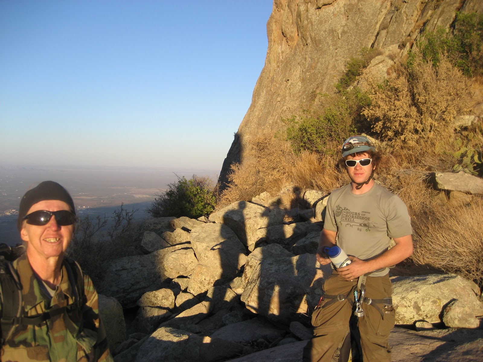
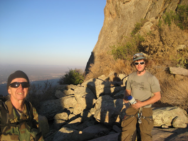
Since we were starting from Aguirre Springs, our start time was constrained by the time the ranger opens the gate. We arrived just at 8am, just in time to watch the sleepy volunteer host unlock the gate. The first part of our hike was pretty mellow, a mile or so up the "northern" fork of the Pine Tree Trail. We left the Pine Tree trail at the same location Marta and I diverged last time, when we were going after the Low Horns. The red balloon is still there. This was Jon's first real hike in the Organs (he had only been on the Baylor pass trail before) and also his first big hike on his newly recovered broken leg. Boy was he in for a day! The gully up to Big Windy saddle is not too brushy by Organ Mountain standards, and Marta and I were quite used to it and cruised on up. Jon, did his best to follow, and already was making comments about how this was much tougher than he expected. We gained the saddle and took a little break, leaving a 1/2 gallon cache of water.
SRE as viewed from Big Windy Saddle
The traverse from the Big Windy Saddle over to the top of Rabbit Ears canyon ended up being our toughest bushwhack of the day. Not only was the terrain we were traversing pretty steep and rocky, but there was no good path to avoid lots of brush, mainly mahogany, spanish daggers and the like. At the top of Rabbit Ears canyon is a small saddle where we took a quick rest, then plodded throuhg more thick brush to reach the gully between South Rabbit Ear (SRE) and Middle Rabbit Ear (MRE). Once in the gully we were on familiar ground and smooth sailing up to the MRE/SRE saddle.

We dropped packs at the saddle, and scrambled up SRE very quickly. Instead of the Normal route, I led Jon and Marta up another easy looking route more to climbers right. This ended up being a series of nice corner systems and beautiful rock, with nothing harder than 4th class. We signed the Summit Register, but somehow I had forgotten to bring a copy of the last transcription I did, so I wasn't able to leave it. Guess I'll have to climb up here again soon. We descended the Normal Route and immediately started gearing up for the MRE.
Jon scrambling up SRE
The MRE was our toughest peak of the day, and took the biggest hchunk of time. Jon was super keen on leading, and I was happy to hand the rack over to him. In tretrospect this might not have been the best idea. Jon is a solid climber but new to trad. Also the rack I brought was very thin, only nuts and my set of tricams, no spring loaded camming devices at all. I was interested in seeing if I could climb the route in my approach shoes (5.10 Exum guides, with nice sticky rubber) and doing it on top-rope seemed to make sense. If I could climb the route in these shoes, than I probably wouldn't need to bring climbing shoes when/(if) we do the entire ridge, saving considerable weight. Jon had his climbing shoes, and after quickly racking up was on his way up the first pitch.
Jon leading up the first pitch on MRE
He dispatched the first pitch quickly, and sailed the large crack section under the chains. Due to my thin rack, he wasn't able to place any protection for this 25 foot crack, but said he felt perfectly comfortable on it. I climbed up second, and didn't have any problem dispatching the pitch in my approach shoes. I trailed Marta's thin 8mm rope behind me, and while Jon belayed her up on that rope, I traversed over to the P3 belay with the lead rope.

P3 was the crux for us.  I didn't really remember how difficult it had been when I had climbed it before, but when Jon got to the off-width crux "lip" he was struggling and cursing. One of the biggest challenges seemed to be climbing this pitch with a pack on. The crux section is easier if you can "scum" your back on the right hand wall, but with a pack on this was impossible. Jon eventually made it up, but he said it was some of the scariest climbing he had ever done. Fortunately, there is a nice pink tricam pcket just below the crux, otherwise we would have needed a big cam to make this pitch safe.
Butt shot of MArta at the crux 3rd pitch
Marta went up second this time and also struggled at the crux. Eventually it was my turn. I opted to try it in my approach shoes still, but as soon as I hit the crux I was struggling too. Fortunately for me, I remembered a trick i had read about offwidth climbing: I backed down to a stance, then took off my pack and clipped it to my harness with a long runner. This let me climb up through the crux (using the chimey-like back-scum). It was still difficult, but I managed to get myself, then the pack up. Feeling very hot and thirsty from this excursion, I slowly finished the rest of the pitch.

While we had completed all the 5th class climbing, we still had a steep 3rd class scramble up to the summit. It seemed we all took a while getting up this, but eventually we were at the summit, taking water and food and admiring the view. The wind was picming up slightly but overall not bad. I looked at the time though and it was already 2pm! We were going to have to start making serious time if we were to get all the way to Baylor pass.
Summit shot on MRE
Feeling the pressure, I started down the north slope off the summit to start finding our rappel route. instead of using the normal rappel route, I wanted to find a new rappel route down the North face, which would put us right at the foot of one of the NRE routes. The north side of the MRE has a huge pulpit like rock formation called the Churchkey, and I was hopuing we could rappel down it's west corner. I was able to down-climb almost all the way to the top of the Churchkey, in fact I think I could have done it, but some of the down-climbing was more difficult than I liked, and I was sure Marta wouldn't be comfortable on it, so we set our first rappel at the top of a corner system about 20m above the churchkey ledge.
First rappel off of MRE North side
Before I get too far ahead of myself, let me say that the Churchkey is amazing. None of us could resist scrambling up its 30deg perfect slab to a nice little crow's nest perch. It's one of the nicer little exposed ledges of any that I've been on.
Shot from on top of the Church Key
The west corner of the Churchkey is pretty vegetated, and I was partially hoping we would be able to down-climb much of it. This wasn't really the case, we only got 15m down before it became too steep to down-climb, at a large chimney section. We set another rappel, and 30m put us on a nice big ledge beneath the chimney, but above the off-width/squeeze that had shut me down when I had attempted this route with my father almost a year ago. Here we found a decent piton to rappel down, and another 30m rappel just barely landed us at the bottom, where we were able to scramble the rest of the way to the MRE/NRE saddle. So far so good, all the rappels we could do with a single 60m rope. This is another key piece of information I was hoping to learn today; if we can do all the peaks with a single rope we save a lot of weight.

The wind was really starting to pick up while we rapped down, but once we got close to the NRE we were sheltered from it. Our planned route up the NRE was the Davis Route. I had climbed the upper portion of this with Zach a while back, but have never climbed the lower portion. However, it is supposed to be 5.4 or easier, and it certainly didn't look harder than that. For this route, I decided we'd simul-climb. I had to give jon and Marta a quick lesson on simul-climbing, some basic dos and don'ts. I took the lead, marta tied in 30m behind and Jon took up the caboose. We made slow and steady progress up the entire route. It was as easy as I had hoped, and I felt that I could have gone much quicker up the route, but simul0-climbing doesn't let you go at your own pace. Inevitably, one person has to slow down at a steep section, while another is waiting around on an easy ledge. But overall, we dispatched the route very quickly, and were soon on the summit of the NRE.

Again, we took a little break, but it was already 5:30 and we didn't have much daylight left. We left 2 small water bottles on the summit as another water cache, then headed over to the North side to find another new rappel. There is a steep gully on the north side which we were able to down-climb quite a ways, but eventually needed to set up a rappel on. After one rappel we down-climbed some more, but it became clear that this gully led down the east side of the NRE, and not to the CWM/NRE saddle. At a logical spot, we traversed out of the gully to the west and found a perfect ledge right above the CWM/NRE saddle. The only problem was it was more than 30m down. in fact none of us were even sure it was less than 60m down.  The wind was really howling around this face of the mountain, so we couldn't really drop the ropes and see if they would hit. Jon attmepted to tie a rock to the end of Marta's 50m rope and lower it down, but the rock came loose. Eventually I decided we'd just go for it. We were limited by marta's rope to a 50m rappel. I took the rack with me just in case, and started down. I had to lead the rope as I went, the wind  had blown it all over the face and it wasn't obvious that I'd reach the saddle until I was almost there. With relief, I landed. It is a near perfect 50m rappel, straight down a steep cliff. Looking back up, there were cracks all over this face and I bet some fun hard climbing could be found here. But we had to turn our attention elsewhere.
Looking out over the CWM towards Baylor Peak
While Jon and Marta were rappelling down, I scrambled up to tag the CWM's summit. I think I described this as 4th class scrambling before, but it could jsut as easily be "low 5th" . You ahve to climb up a smooth slab face before gaining the "pitched roof" summit slab. I felt good climbing up and down it, but I'm not sure it would meet everyone's comfort level. Neither Marta or Jon seemed that interested in tagging the CWM, the sun was getting low and we were all thinking about how we would get down. We scrambled down the west gully between the CWM and NRE, and had to do one more 30m rappel before we were down in the scrubby bushes surrounding the peak.

It was 7pm, and we had some decisions to make. It was clear to me that we wouldn't be going after Last Peak or Nordspitz. None of us had a desire to be scrambling and bushwhacking in unkown terrain by headlamp. The only problem was we didn't have a clear route down. We could very easily have descended Rabbit Ears canyon, a route I know well, but this would leave us on the wrong side of the mountians from where we parked, and we'd proabably need to get picked up by someone. The option of scrambling around Last Peak and Nordspitz on the west and then hiking down the ridge to Baylor pass seemed even less inviting. None of us knew this terrain, and it was still a very long ways to Baylor pass, going this way would surely mean hiking out by headlamp. our last option was to try to descend directly to the east down a gully, but again none of us knew the terrain over there.Some of the gully's on the east are horrendous (my experience on Lost Carabiner route attests to that) and I was hesitant to try this.

Marta suggested a 4th alternative that I was about to go agree to. We would descend Rabbit Ear Canyon for a ways, but then climb up to a ridge-line where she was familiar with the terrain,. The ridgeline would then lead us to Baylor pass. This option would be very long and grueling, but offered some hope. Plus, if we got most of the way down Rabbit Ears canyon and decided we weren't up for it, we could simply keep going down and get picked up (i already had called my wife and she said she was willing to come rescue us). All of us thought this sounded reasonable and Marta and Jon started heading down. I was right behind them but something told me to at least scramble over to the saddle between the CWM and Last peak and check it out. From our stopping point we couldn't actually see into this gully. I quickly scrambled round the corner and liked what I saw. The gully was brushy, but not bad at all, and not very steep either. I called Jon and Marta over.
Losing Daylight, Saddle between CWM and Last Peak
After looking at the east side gully, they also agreed that it looked better and soon we were off, racing dusk. Going down was quick and treacherous. These mountian gullys have thick vegetation in spots, loose boulders in other, and slippery ball-bearing gravel. Still we made good time. Most of the thick-looking brush turned out to be wild-grape (not the prickly briars I ahd feared). Marta did bang her knee in a hole, and Jon took a few big slip/falls, but we made it down to the Baylor pass trail just as it was dark. By headlamp we marched the 1 mile back to the car.
Brushy gully east of CWM/Last Peak
Even though we didn't make it all the way to Baylor pass, we learned some valuable information: MRE is definitely the hardest peak of this section and will need some extra attention.

  1. It can be climbed in approach shoes though, but we should probably bring a big cam to preotect it better.
  2. Rappels down the north sides of MRE and NRE work great (and already are equipped thanks to us). We took 3 30m rappels to get off MRE, 1 30m and 1 50m rappel to get off of NRE and 1 30m rappel to get down the CWM. Looks like having two ropes may be needed.
  3. We left water caches on NRE and Big Windy.
  4. the Davis route is as easy as it was supposed to be, and a good way to summit NRE.
I still need some more information on this section though, specifically the route from CWM over Last Peakand Nordspitz, as well as the terrain down to Baylor Pass. It would also be good to find a better route between Big Windy and the SRE. It would be appealing to go from Big Windy up to the Rabbit Ears Massif (and looks less brushy), and then down to SRE. This might involve more climbing, but could be less brushy, and would add an extra peak into the mix. Looks like there's plenty left to explore later.

Pictures coming soon. Also more summit registers coming soon. i replaced the register on top of the NRE, and have the old one to transcribe.

Friday, May 13, 2011

Organ Mountain Summit Blitz

Ever since we moved to las Cruces, the idea of linking all the Organ peak summits in a day has intrigued me. Since then, I've had the chance to summit individually many of the peaks and have gained a pretty decent familiarization with this rugged and beautiful range. But until recently I haven't given a whole lot of serious thought to the endeavor. It seems impossible, and it may yet be. But a new member of the rescue team, and a passionate climber is keen to give it a try and I've been sizing it up again.

Despite having climbed most of the peaks, there are still regions of the ridge line that I am unfamiliar with. Therefore the first order of business is to scout out these areas. Also it is clear to me that any attempt will need to travel fast and light, a near impossibility with the desert heat. Water caches are a must, so these scouting hikes should also serve to cache water in strategic locations throughout the ridge.

With those ideas in mind, I struck out for a solo trip to link up Organ Needle to the Wedge, with a possibility of going even further with time permitting. I left Las Cruces a little after 4am and after a quick gas stop, was leaving my car on Modoc road at 450 am. The quiet cool morning is perfect for hiking this easy stretch. I got my first surprise at the BLM gate, where someone was camped out. I startled him awake and he yelled "HEY!", making me jump as I hadn't really noticed him. "I'm just hiking, no worries" was my reply and hike on I went.
Feeling Good at Juniper Saddle
As I neared the top of Modoc road, I was able to put my headlamp away, the morning twilight was enough light. I flew by the regular landmarks on the trail up to the needle; Yellow rocks 6:06am, Juniper Saddle 6:37am, Dark Canyon Pine Tree 7:07, Organ Needle summit 7:26am. The cool morning and fresh legs made the going smooth. even so, I was happy to unload a gallon of water on the top of the Needle as a cache for future use.

I took a short break on the summit, and rifled through the summit register. There were several full notebooks filling up the container and I decided to take them down with me for archiving. It will be quite a project to log all these books, but I usually enjoy reading all the different accounts of who travels these mountains.
Organ Needle Full Logbooks, coming along for the ride
The summit was also my first chance to survey the extent of the recent fires. Large portions of hillsides were charred, but there were also untouched slopes. The fire had been very selective, constrained by geographical and meteorological forces no doubt. I tried snapping some pictures but with the morning sun glaring right at me I wasn't able to capture it very well.

I descended the NW ridge of the needle, a route I had climbed a few years back. The down climbing was a bit exposed but solid. I left a poot sling to make the single 30m rappel down to the saddle. Once in the sadle between LST and the Needle, I climbe dup a short rocky headwall rather than traverse into the main gully. This followed the way I had descended from LST previously during the Lost Carabiner Route fiasco.  It involves some low fifth and fourth calss moves, but is a quicker cleaner way to get over to LST.
Scramble traverse into LST gully
I was on top of LST by 8:33am, still making good time. The next part was the section I was least familiar with. I scrambled around the summit blocks for a while trying to find an easy way around, but ultimately decided on a short rappel to get down off the summit blocks to the north. I rappelled down a off-width crack which ended in an overhanging cave-like area. While transitioning to the overhang, my rope slipped into the crack and I grated a bunch pf skin off my left knuckles. Painful, but not serious. Also, looking back it did not seem that this would be easily reversible. One of the things I was keeping in mind is whether to try the organ ridge North-South or South-North. certain sections are easier one way or another, for instance the Low Horns work better North to South. Travelling from the Needle to the Wedge seems to work better South to north, especially because of this section. If we were to attempt a North to South, we'd still need to route-find a way to get to the top of LST.
My painful rappel spot off of LST
The rest of the way between LST and Square Top was pretty straightforward, and actually pretty nice. I was able to stay up on the ridge for most of the way. At one point I had to descend on the west side into a gully byy a large pine, and there was a bit of brush to negotiate but nothing serious. The final down-climbing to the Square Top headwall was exposed but comfortable climbing. Actually summitting Square Top requires climbing an exposed fifth class pitch and I wasn't about to attempt this on my own, but it probably would only take 30-60 minutes to accomplish. I didn't stay long by Square Top, and headed down the familiar terrain of the regular ascent route. This involves some down-climbing on the west side. The rappel anchors John Bregar and I had previously used were still in decent shape so I utilized them to rappel the short "4th" class section and then down-climbed the rest of the way down the Square Top gully.

At the bottom of the gully was more new terrain for me, I would have to traverse out of the gully to the north and find a point to cross over onto the east side of the ridge to reach the Wedge's standard route. The initial bush whacking to get out of the Square Top gully was the worst of the day, consisting mostly of dense and dead brush oak scrub. After only a short ways, i opted to ascend back up to the ridge-top following a faint climbers trail. This placed me on a nice perch between Square Top and the Wedge.
Looking North with the Wedge behind me
In between me and the Wedge was an un-named peaklet that I would need to negotiate. Going around it to the west didn't seem like an option, and it looked like I would have to descend a steep gully on the east side and meet up with the gully that runs to the Wedge lower down. but on closer look, there appeared to be a brushy ramp which led directly from this little saddle around the peaklet to the east. I scrambled down the ridge-line to this little saddle and on closer examination this little ramp looked perfect. It let me maintain elevation on the ridge, and skirt around the rock obstacle. Once I turned the corner at the end of this ramp, I was in an oak/maple forest typical of the shady east side gullies. This one had been hit by the fire, and had a powder soft layer of ash blanketing the ground. the trees themselves looked like they survived, but the fire had torched all the leaf litter and small shrubs.
Burnt Forest
Hiking down this short section of forest was kind of surreal. The ash was very much like fine powdery snow. The smell of fire hung in the air. Only a week or two ago this area was burning, and now it was still and calm. Once we get some rains I have no doubt that the plants will come back with a vengeance.

By the time I joined up with the Wedge's regular route it was getting hot, and I was slowing down. I finally summited the Wedge by 11:28am. Good time, but not fast enough to do the entire Organ Mountain ridge. My legs were beginning to ache, and my camelback was already empty. I only had one more 32 ounce water bottle left and considered heading back to the car. To go on would surely mean I would run out of water while still high in the mountains. While I was having these thoughts, I holed up under a boulder, the only decent shady spot on the summit and tried to eat some food.
My shady nook on top of the Wedge
Somehow ambition got the better sense of me. I decided to keep going towards Dingleberry. I had previously covered the terrain from the Wedge to the saddle between Third Peak and Lost Peak, but there was still some unknown terrain to be scouted out. I rappelled off the Wedge and scrambled down beneath Lost Peak. Lost Peak is another summit that from the south requires a rope and partner to get up (at least, i wasn't going to solo it) and since I knew this already, I decided to try to bypass Lost Peak. I did this by descending the steep gully on the east. This down-climb  turned out to be steeper than I was hoping, involving 4th class scrambling. Still it put me almost right where I wanted to be, in the saddle on the south of Third Peak. the last time I had been here the group I was with decided to head down without trying this little peak, so today I decided I'd give it a shot. It turned out to be a very nice albeit exposed scramble, probably only high 4th class. The summit is a small sharp knife-edge, with a decent little belay spot to put my pack down. the time was 12:37pm. There was what appeared to be a small summit cairn about 30 feet out on the knife-edge, so I scrambled over to see if there would be any signs of a summit register. Sure enough, a small yellow-metal Kodak film canister was stashed in the cairn. In it were 3 neatly folded sheets of note paper containing the first ascent parties' log and the next 4 ascents as well. The last record was dated 1972. I love finding these kinds of logs. A little bit of Organ Mountain history, getting to a place that maybe no one has touched in 40 years. It's a great feeling.
Third Peak's little summit cairn and knife-ridge
It looked like a double-roped rappel off of Third Peak's north side might work, but I didn't have that kind of rope with me, so I down-climbed my ascent route. ASctually, the elevation of the saddle between Third Peak and Lost Peak is a little bit higher than where I wanted to join up with the regular acent route of Dingleberry so this worked out pretty well (and would work in the opposite direction as well). Lost Peak also looks to be easily scrambled from the north side which is good to know if we end up trying a North to South trip of the ridge.

My route to the summit of Dingleberry was unremarkable. I had to bushwhack a bit to get over to the ascent gully, but it wasn't very bad. The main thing that was getting at me was exhaustion and dehydration. I was nursing my last water, but the heat of the day was sapping me quick. I took advantage of every shady spot to rest and try to recuperate, but I was still slowing down. I finally reached the summit of Dingleberry at 1:21pm.  The summit log I replaced a year or so ago is in good shape, and there has even been some traffic up here.
Dingleberry, the 5th summit of the day for me!
My memory was telling me that the Wildcat gully would be a better descent route, and since I was going to be going down Wildcat gully, I might as well tag Wilddcat too, since it is not far to go. I was able to down-climb most of the descent off Dingleberry to the north (passing by one rappel station that Bob Cort and I had previously used), but the final 20ft boulder drop stopped me. I set up this short rappel, and only after getting down did I see that there might be a way to bypass this drop without needing a rappel. Again, this would work well for a North to South excursion.

Once down in the Wildcat gully I decided to shuck my pack and go light up to the top of Wildcat. I still was nursing my water but I knew it was down to the last few sips. I was exhausted, but I slogged my way up to the top of Wildcat. the time was 2:30pm. I brought a copy of the old summit log to leave, so future parties will have a chance to read the history of this little peak. Then I turned around and started my descent.

Despite travelling on familiar terrain, the exhaustion and dehydration made the descent very trying. I sucked my last few drops of water down while still high in Wildcat gully, and the whole rest of the way I was fixated on nothing but water. I sang songs to myself to try to keep my mind occupied. I cursed myself for leaving an entire gallon up on the Needle. By 4pm I was at the top of Wholt's Welt. By 4:28pm I was back on Modoc road. One foot after another I just kept moving on. The lower I got, the hotter it was and I began to feel some of the signs I'd felt before.Nausea, cotton-mouth, tingling limbs. I held a glimmer of hope that the guy camped at the BLM gate would still be there and I could beg some water from him, but no such luck. I finally made it back the car at 5pm.
Shady spot in Wildcat gully where I tried to regain my composure
When I finally got home, I was useless for a few hours. I slowly re-hydrated, washed all the salt off my face and took a well deserved rest. The 6 summit loop had clocked in at 9.47 miles with around 5300 ft of total elevation gain, and was about a 12-hr trip car-to-car. So is the entire ridge doable? Maybe, maybe not. This portion represents about a third of the ridge-line, and I had to skip two of the peaks. Also my I'm beginning to doubt my physical condition for taking on the whole ridge. This "little" portion nearly did me in. Still I can see how it would be possible, and am already thinking about the next "scouting" trip.

Saturday, April 9, 2011

Cooke's Peak Hike with OMTRS members


I led an OMTRS "area familiarization" training hike to Cooke's Peak. the forecast on the day of the hike was an ominous 60 mph wind advisory, but we decided to go anyways. We met at Truckstop America at 6am, Chris Pennise and Kurt Anderson were the only two members foolish enough to join me today. We started hiking around 8am and were following the route description described in Greg Magee's Day Hikes and Nature Walks in the Las Cruces, El Paso Area. A few times in the approach gully it was hard to find the trail, but most of it was pretty distinct and easy going. By the time we reached the ridge top, winds were starting to pick up but it wasn't bad at all. The 2nd class section was short, and we spotted a peregrine Falcon nest nearby. They squawked at us a bit when we scrambled down to a nice observation spot to peer down into their nest. I didn't see any young or eggs, but one of the adults displayed brooding behavior, so they are probably on their way. It started getting stormy while we were on the summit, but nothing close to 60 mph winds, not even 20mph. The descent was pretty uneventful, except for one "short-cut" that I led them on to help me play with my new GPS features. We were back at the car by 3:00, and would have made it back to Las Cruces in good time if we hadn't detoured to some old Fort Ruins nearby. The wind was finally really picking up, and soon even the nearby Cooke's peak was obscured in dust. Good thing we had an early start, making for a perfect day of hiking.

Friday, April 1, 2011

Article in Sun News

Kind of silly, but I was interviewed by a local reporter about names of peaks in the Organs: http://www.lcsun-news.com/las_cruces-news/ci_17749820

Saturday, March 26, 2011

ORP - Orgy


Marta Reece with NRE in the background
After last week-ends botched attempt to rope-solo the route Orgy on ORP, I returned this week-end with a climbing partner, Marta Reece. We made a fairly early start, I picked her up a 6:30. It was actually fairly cold and breezy on our hike in but we made good time and were racking up at the base of the route at 9am. As we were racking up both of us were shivering, it was definitely much cooler than last week-end. I quickly led up the first pitch, staying more to the right than before, on 5th class rock (instead of the easier ground to the left). this pitch climbs past a tree and ends up on top of the first shoulder. The top of the first pitch I was in the sun and began to warm up. I brought Marta up quickly so she could warm up as well.

Looking up at the 3rd pitch. 
The second pitch I had rope-soloed before, but even with a proper belay, I felt a little off. It involves some fist-offwidth like cracks, which are not difficult but felt awkward to me. I'll be the first to admit that I am not in good climbing shape anymore. I retrieved the gear I had bailed off of last week-end and set up an anchor below the steeper wall that had intimidated me before when I was solo. This made for a short second pitch, but we were in the sun and quite comfortable.
Looking down from the 3rd pitch
According to the topo I had brought the 3rd pitch was the crux, if you could call 5.6 a crux. It looked almost wide enough to involve chimney climbing and there were a couple dead brushy growths. I hacked away the growths without much of a problem, and found the climbing above to be excellent. Good moves and protection up through the steep wall, but very comfortable feeling. The steep wall was only 60 ft or so high and above was some easy scrambling to reach the top of a large shoulder on the E buttress of ORP. I chose a belay spot near the top, but in a pretty direct line from where Marta was belaying me.

We consulted the topo before continuing. from the shoulder the buttress had another steep headwall, but it looked harder than the 5.4 suggested by the topo, and also fairly dirty. A comment on the one of the topos mentioned going around a corner and then up a 5.4 dihedral, and the only thing that seemed like it matched this description was to scramble over some blocky terrain down into the gully on the left of the buttress. After I had done this there was a dihedral-like corner on the right hand side of the gully which would top out near the small saddle beneath ORP. Despite placing little gear and having, I ran out of rope about 1/2 way up the corner, and had to stop and belay Marta over. She wasn't too happy about the traverse/scramble intothe gully, I had not protected it well for a second, and she faced a serious fall if she had slipped, but once in the gully she felt better.
Marta scrambling off the shoulder and into the gully on our 4th pitch
Our final pitch up the corner had one interesting section/move, which was a big reach to a good hold for me, and more technical for Marta. I guess you could say it was a 5.4 move, but at this point I don't trust my abilities to rate climbs much. At the top of the corner I passed some old rappel slings, and then I scrambled up 3rd class terrain until I reached the end of the rope, only a short distance from the summit. We didn't dawdle long on the summit, it was pretty windy. I put a copy of the transcribed summit register in the new jar, and we scrambled back down for our descent. It was 12:30.
Glorious summit


For the descent we decided to rappel down the gully on the south side of the buttress, which would put us right at our gear. From the rappel slings at the top of the 5.4 pitch, a 30m rappel landed us in the gulley, where it was broad and brushy. We hiked to the bottom of this section and the top of the large chock stone that had stopped me on my first scramble attempt back in January. the rock above this chock was very loose and we tumbled down a few pieces while searching for something to rappel off of. Moving the rock opened up a hole behind the chock which I thought we might be able to chimney down, but Marta didn't like the looks of it. The walls were pretty far apart for easy chimneying. One bad effect of the hole was that wind funneled up it and kept blowing loose dirt in our faces and eyes. Marta found us a climb of living shrubs that she thought we could rappel off of, and when I went up to get a closer look, I found an old 2-piton rappel anchor hidden in lichen just off to the side.
suspicious looking piton rappel anchor
The top piton was not very deep in the crack, and did not lend confidence but the bottom one looked decent. I was ready to use the pitons, but Marta felt more comfortable using the climb of shrubs, so we used them. Rappelling down the chock was only 20 ft to another brushy area, and I was hoping we could continue down past another chock/steep section, but it was clear that the rope would not reach to the bottom of the next section, so we pulled it down and set up for a final rappel. Again, we were shifting through loose rock to try to find something to anchor off of, and then spotted some old slings off the north side of the gully. the only problem was that to get to the slings involved a very exposed 5ft move over a steep slab, where a fall would be deathly serious. Unfortunately we had already pulled our rope from the above rappel anchor, but I made it over to the slings by protecting the exposed move with a wired-stopper, then setting up a quick anchor to belay Marta over.

The final rappel was on piton-like stake driven straight down behind a crack. It looked pretty solid, and the sling around it would also be held by the rock. This last rappel put us almost at the very bottom, where we could scramble back down to our packs. It had taken nearly 2 hours to descend.
Final rappel. the first pitch of the climb is on the right hand side past the tree, but could just as easily start from here.
Overall the route was pretty good but not my favorite. The first 3 pitches were on very nice rock, and there is good potential for difficult variations on other crack systems. However, scrambling down into the gully to finish up the 5.4 corner detracts from the climb. It would be better to continue more directly along the buttress, tackling the final head-wall. The descent could also be improved by adding some descent rappel anchors. Another project for another day.

Friday, March 25, 2011

ORP summit register

The ORP summit register that I retrieved last weekend was a good one. Similar to the one found on wild-cat, it was a small metal film canister (rusted out a bit), with bits of folded paper in it. The whole thing had been placed in a larger orange pill container, which would help preserve it, but it looks like this pill container is relatively new. I left a new jar and notebook, and plan on bringing up a copy of the transcription when I next climb up there (tomorrow). The register did not have many entries, but it did have entries dating back to the 60's and the early Organ Mountain climbers. Very cool.